Similar to Lemosho, approaches from west, remote, less-frequented, beautiful heath section, very scenic with southern traverse, camping, difficult route but excellent for acclimatization
Around Londorossi Village and the national park gate is a great location to see the striking black and white colobus monkeys. The first part of the trail goes through the pine plantation and agricultural land growing maize, potatoes, carrots, cabbages, peas and onions.
At 2450 m the natural montane forest begins. The forest is thick with vegetation and climbers such as the Black-Eyed SusanThumbergia alata and the white flowers and fluffy seeded heads of old man’s beard Clematis bracliat.
At 2600 m (8530 ft) the heather zone begins.
The large orange flowers of Gladioli natalensis and pink dangling flowers of Dierama pendula can be seen. Flying between the shrubs is the common robin chat.
By 3000 m (9843 ft) the conditions are so cold and dry that the number of plant types has reduced significantly, leaving the heathers and Adenocarpus mannii as the main species.
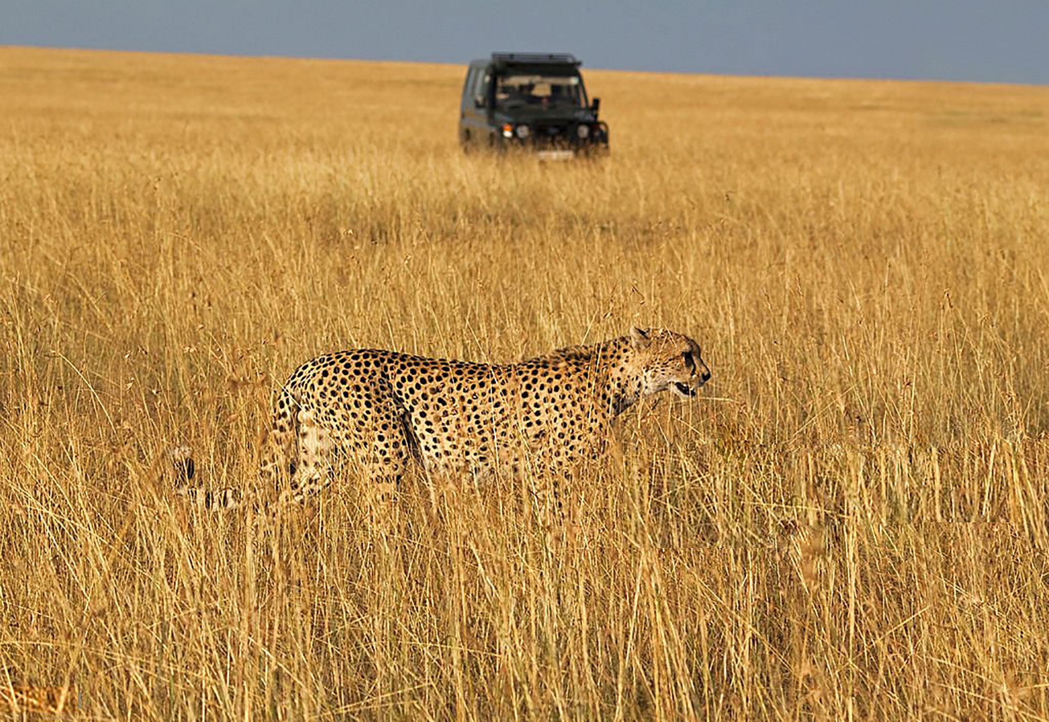
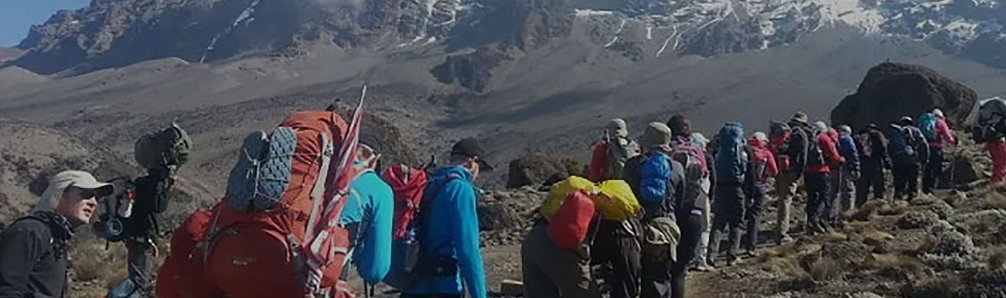
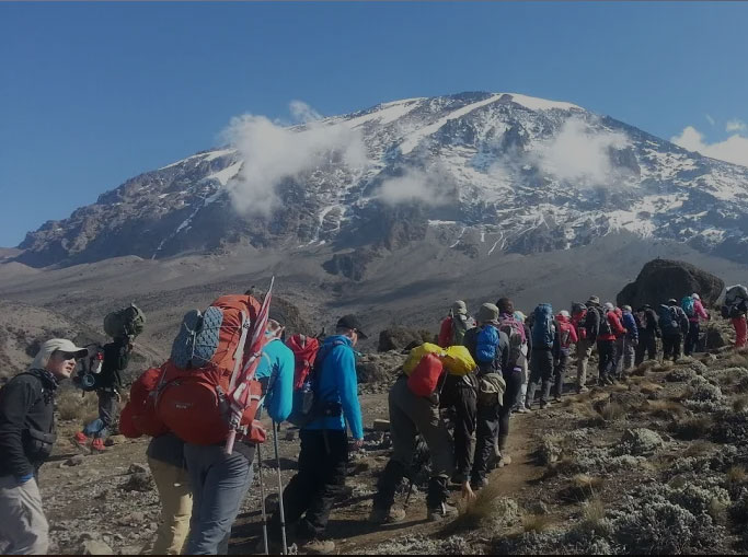
The route heads across the sparsely vegetated Shira Plateau to Shira Cathedral. There are numerous large animals using the Shira Plateau but they are seldom seen. The eland is the most common to be spotted. Fur-filled droppings lying by the path show that Leopards are also visiting the plateau.
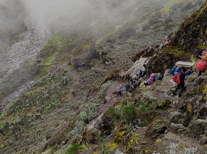
Climbing from Shira Hut towards Lava Tower the vegetation more and more sparse. The rocks here have some moss and lichen hanging from them- proof that this area is often washed by moist clouds sweeping up from the forest zone. Descending from the plateau into the Barranco Valley the vegetation returns and giant lobelias and senecios are abundant.
The first feature today is the Barranco Wall that dominates the view from the campsite. It was formed 100,000 years ago when a huge landslide came down from the summit creating the steep sided Barranco Valley and the western breach of the Kibo Crater.
After the Barranco Wall the route undulates through a number of valleys with good examples of giant Senecios and the yellow spined thistle, Carduus Keniensis. The final valley is Karanga and, having a good water source, it is well vegetated with plants from the moorland zone.
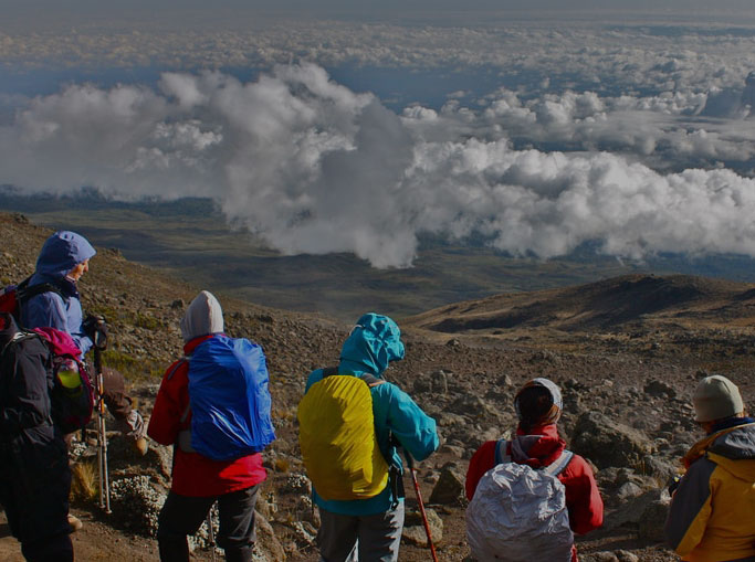
On the way to Uhuru Peak there are very few plants, mainly loose scree and boulders. The terrain is very high, dry and cold, which is unsuitable for most plants and animals. The route to Uhuru Peak climbs the steep side of Kibo, Kilimanjaro’s youngest volcano, to Stella Point passing the remains of the Ratzel Glacier – which was the route taken for Hanmeyer’s first ascent.
From Barafu Hut to Mweka Forest there is an interesting return to life; empty rocky landscapes become dotted with plants which get larger and larger and by Mweka Forest the heather zone has been reached.
The return takes 1-2 days and we will cover the same route that we took for the ascent. Because we are coming down and have gravity on our side, we can afford to take a few breaks to check out the local flora and fauna.
Accommodation: Kibo Hut
Meal Plan : Full Board basis
Another long hike, this time up to Kibo Hut at almost 15,500 feet. Although somewhat shorter in distance, this usually takes 7 hours because it is steeper and the altitude slows everyone down. The route passes directly up onto the Saddle, a wide, flat area with the peaks of Kibo and Mawenzi looming overhead. Views from here can be fantastic. The last part of the trail passes across the arid plateau before ascending to Kibo Hut. Kibo Hut is a stone hut with rooms that sleep 10-15 people in bunk beds. You will have a light dinner, and turn in early for any sleep if possible. The guides give a little pre-climb talk after dinner at Kibo Hut.
Accommodation : Horombo Hut
Meal Plan : Full Board basis
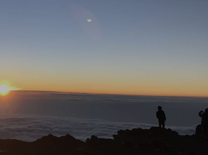
We are awakened about midnight, and have tea and cookies. The guides try to get everyone ready to climb as quickly as possible, leaving between 1:00-1:30 am! Starting off, the trail swings back and forth up a steep scree slope and the climate is bitterly cold. The summit climb is an event you will never forget, with the night sky full of stars and only your breathing to help focus your mind. Most climbers arrive at Gillman’s Point, elevation 18,635 feet,(5685m) in time to enjoy sunrise around 6:30 a.m. The views from the top looking down on the plains of Africa make it all worthwhile. Some climbers decide that they have reached their goal and head down from here. For the strong, the true summit is Uhuru Peak (19,340 feet)-an additional 3 hours away round-trip. The descent from Gillman’s Point is fairly rapid, taking about 2 hours. Most climbers take a short rest at Kibo Hut before descending to Horombo Hut for the night, arriving in the late afternoon. Dinner and overnight at Horombo Hut.
Accommodation : Arumeru River Lodge
Meal Plan : Half Board Basis
Breakfast and continue your descend to Marangu gate and collect your certificates for successful trek. You will then be transferred to Arusha for overnight at Arumeru River Lodge.
Arusha – JRO: (1hr)
Transfer to JRO for your onward flight